
Archaeological Mitigation
Surveys Conducted Nationwide
Email us at geomodel@geomodel.com / 703-777-9788
GeoModel, Inc. conducts archaeological mitigation surveys using ground penetrating radar (GPR) and electromagnetic conductivity (EM). The types of archaeological features that can be investigated include:
Burial Trenches
Old Foundations
Burial Mounds
Old Roads
Buried Metal Relics
Ground Penetrating Radar (GPR)
Ground penetrating radar (GPR) produces an underground cross-sectional image of the subsurface soil and rock. Depths of up to 15 feet (4.6 meters) can be examined at fairly high resolution. GeoModel, Inc. conducts surveys using a GPR digital control unit and various antennas with frequencies ranging from 400 MHz to 1,500 MHz.
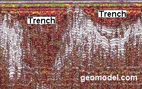
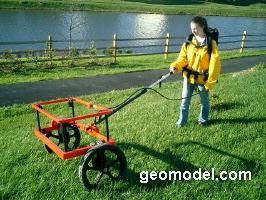
Geophysicist pulling 400-MHz antenna, and example GPR profile of two burial trenches
Electromagnetic Conductivity (EM)
GeoModel, Inc. also conducts EM surveys to detect buried structures, such as old foundations and buried walls.
To the right is an example of how GeoModel's metal detector located old underground, linear metal structures and other areas of buried metal, including metal underground pipelines.
Electromagnetic conductivity (EM) measures the conductivity of the subsurface. This measurement includes the conductivity of old walls, foundations, burial mounds, and buried metal objects found at archaeological sites. GeoModel, Inc. has conducted numerous electromagnetic conductivity (EM) surveys worldwide.
Electromagnetic conductivity surveys are rapid and very accurate. The EM instruments are easily carried around the archaeological site and can easily locate buried metal relics and artifacts in sand or clay deposits. Metal (ferrous or non-ferrous) can be detected by the EM method.
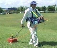
The pictures below show operators with the EM instruments.
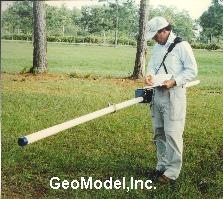
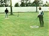
(GeoModel, Inc. uses the new EM metal detector which is more accurate than the standard EM metal detector)
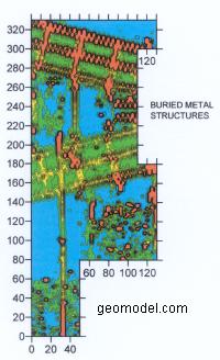
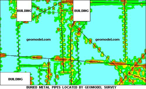
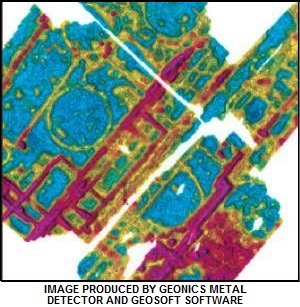
The site scan map (below, left) shows the locations of old buried metal pipes that were located by GeoModel, Inc. with our deep metal detector. The contour map below, right, was produced by Geonics' metal detector and Geosoft's contouring software.
Examples of projects conducted by GeoModel, Inc. for archaeological mitigation are described below. One example is an archaeological investigation at the Gamble Sugar Plantation near Ellenton, Florida, and the other is an archaeological study in Port Royal, Jamaica.
Archaeological Study - Gamble Sugar Plantation, Ellenton, Florida
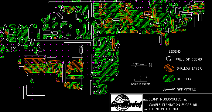
GeoModel, Inc. conducted a GPR survey for archaeological mitigation at the old Gamble Sugar Plantation located in Ellenton, Florida, for Bland and Associates, Inc., a well-respected archaeological firm. An old sugar processing mill once operated at the site. Ground penetrating radar was used to obtain additional subsurface information about the site, including areas of buried debris, old foundations, and old walls.
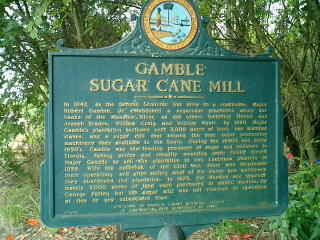
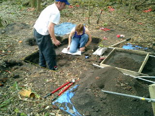
The photos above show a sign describing the history of the Gamble Sugar Plantation and two Bland and Associates archaeologists excavating a pit near one of the existing sugar mill walls.
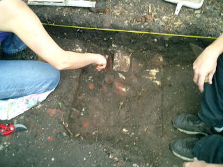
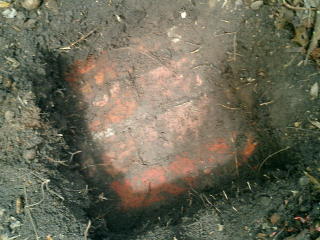
The photos above show the Bland and Associates archaeologists clearing away soil from an old brick foundation or buried wall and a close-up of a portion of a brick foundation, wall, or column.
Archaeological Study - Port Royal, Jamaica
GeoModel, Inc. conducted a GPR survey for archaeological mitigation at the Port Royal Archaeological site. Port Royal, Jamaica, was destroyed by an earthquake in 1692 and efforts are being made to restore the original city and to create an area for tourism.
Ground Penetrating Radar was used to examine the subsurface for old building foundations and walls. The ground penetrating radar survey was conducted in the streets of Port Royal and in other areas of the city.
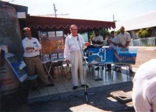
The public gave considerable attention to the GeoModel, Inc. GPR survey due to the importance of the archaeological mitigation study. A News Conference was held on January 21, 1999, during which newspaper photographers and journalists were present.
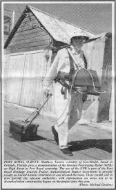
Matthew Turner, Senior Geophysicist for GeoModel, Inc., gave a demonstration of the ground penetrating radar survey method in Port Royal, details of which appeared in a Kingston, Jamaica, newspaper (above left).
Mr. Turner also gave an oral presentation to the media in Port Royal (above right), explaining ground penetrating radar techniques. Members of the Port Royal Heritage Tourism Project development team also gave presentations.
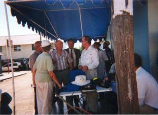
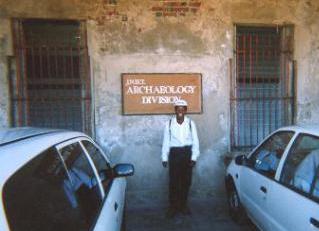
Mr. Turner (above left) discusses GPR techniques with Ainsley Henriques, Chairman of the Jamaica National Heritage Trust, and Dorothy Griffiths (above right), a member of the Archaeology Division of the Jamaica National Heritage Trust, gave considerable assistance during the ground penetrating radar survey.
Company Background
GeoModel, Inc. was founded in 1991 as a geophysical services and environmental consulting firm. The company principals have over 50 years of combined experience and have conducted numerous EM and GPR surveys to locate buried objects at archaeological sites and conduct archaeological mitigation investigations for public and private clients. All projects are conducted or supervised by registered professional geologists.
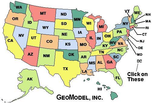
For a ground penetrating radar survey, click on your state below:
e-mail: ![]() geomodel@geomodel.com
geomodel@geomodel.com
 [Back to Top of page][Back to GPR Applications page]