
Brine Pit Location
Surveys Conducted Nationwide
Email us at geomodel@geomodel.com or phone 703-777-9788
All brine pit detection surveys are conducted or supervised by:
Certified Professional Geologists (PG)
40-Hour OSHA Hazwoper-Trained Professionals
TWIC Certified Professionals
ISNetworld Member Company
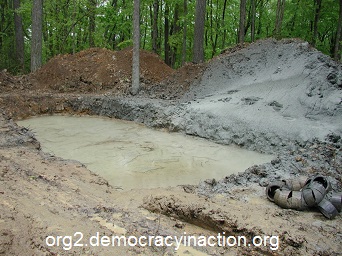
A brine pit is a surface impoundment used to store or evaporate water used in the drilling, mining, or processing industries. The brine pit water may contain salts, minerals, or other substances. After the brine pit is no longer used, it is sometimes covered over with dirt or a liner.
The photograph on the left shows a typical brine pit before it has been covered over. After a brine pit has been covered, it is difficult to detect a brine pit. This is when a brine pit locating survey by GeoModel, Inc. is needed for detecting the brine pit.
GeoModel EM Survey for Locating Buried Brine Pits
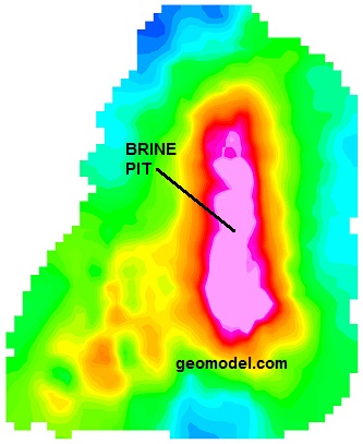
GeoModel can locate a former brine pit in real time, to a depth of approximately 20 feet, just by going down dirt roads or other accessible areas with the electromagnetic conductivity instrument. The area of increased electromagnetic conductivity readings (red area) is indicative of the brine pit location, due to the high conductivity of the salts in the soils and groundwater.
Areas of brine impact extend to the orange and yellow colors. Green and light blue colors indicate that the conductivity readings are near the background (non-impacted) values.
From the field data, GeoModel, Inc. can create a color-contoured Google GeoModel Map of your property, using EM detection instruments and computer processing to create a full color contour map showing areas of buried brine pits or other inorganic materials.
The color-contoured image (Google GeoModel Map) above was obtained using electromagnetic conductivity with GPS positioning. GeoModel, Inc. can prepare a Google GeoModel Map for any area covered by Google Earth imagery.
GeoModel EM Survey Methods
For a GeoModel EM Map, mapping is done automatically using a vehicle or ATV driven system or a walking survey. Results can be obtained in a short time period, making our system cost-effective for large industrial sites, as well as for smaller sites. Buried brine pits are located and mapped in real-time using our unique technique, and later computer processed and color contoured for final presentation.
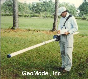
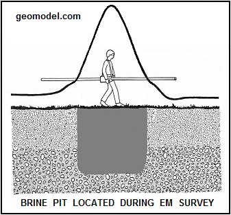
GeoModel EM Operator Conducting Survey to Locate Brine Pits and Burial Trenches (above left)
Increase in EM Conductivity Readings Over Brine Pit (above right)
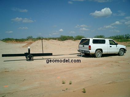
GeoModel Truck Mounted Brine Pit Detection System (above left) and
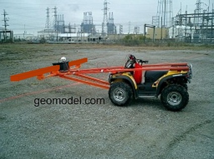
GeoModel ATV Mounted Brine Pit Detection System (above right)
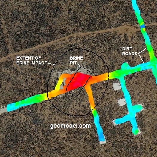
Another example of GeoModel, Inc.'s Google GeoModel EM Map for subsurface brine pit investigations is shown below:
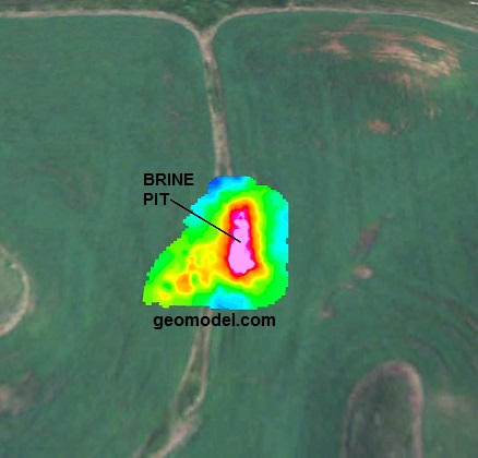
From the ground surface, the location of the former brine pit (above) could not be seen, nor on the aerial photo. The GeoModel, Inc. EM ground conductivity survey quickly and efficiently located the subsurface brine pit.
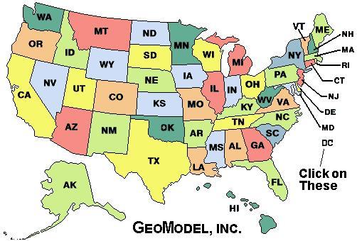
For a ground penetrating radar survey, click on your state below:
e-mail: ![]() geomodel@geomodel.com
geomodel@geomodel.com
 [Back to Top of page][Back to GPR Applications Page]