
Geologic Consultants
Email us at geomodel@geomodel.com / 703-777-9788
Company Background
GeoModel, Inc. was founded in 1991 as a firm specializing in geologic consulting, geophysical surveying, and environmental consulting. The company principals have over 50 years of combined experience as geologic consultants and have conducted numerous geologic projects worldwide. All geologic consultants at GeoModel, Inc. are registered professional geologists.
Areas of Geologic Consulting
geologic mapping of rock units and soil layers
bedrock profiles
buried channels
geomorphology
flood plain analysis
fracture trace and lineament analysis
caves and karst
geologic fault studies
mining and minerals
geologic hazards
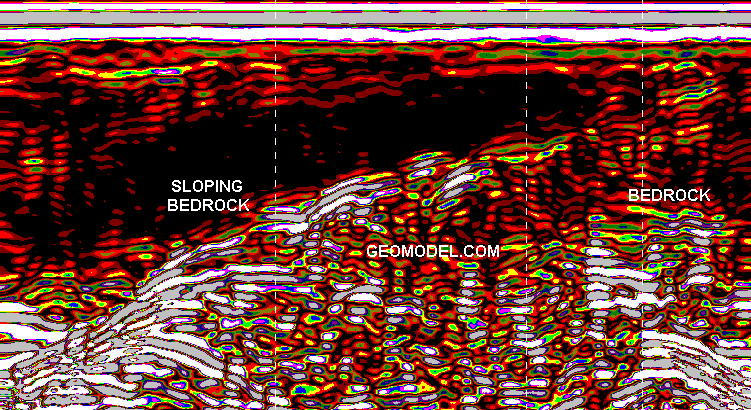
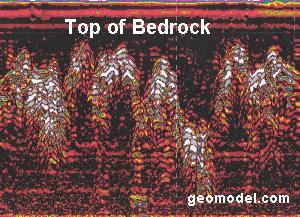
The image above shows sloping bedrock in the subsurface. This image was obtained using ground penetrating radar (GPR).
Methods for Geologic Investigation
GeoModel, Inc. uses various methods for investigation of the geologic conditions in an area. Visual observation, professional knowledge, and aerial photograph analysis are some of these methods. GeoModel, Inc. also uses various geophysical methods to assist in the investigation of geologic conditions at a site or property. The sections below discuss some of the methods that GeoModel, Inc. uses.
Ground Penetrating Radar (GPR)
Ground penetrating radar (GPR) produces an underground cross-sectional image of the subsurface soil and rock. Depths up to 30 feet (10 meters) or more can be examined. GeoModel, Inc. conducts surveys using a GPR digital control unit and antennas with frequencies ranging from 200 to 400 MHz.
At geological mapping sites, GPR can locate buried stream channels, obtain bedrock profiles, and provide cross-sectional images of soil layers.
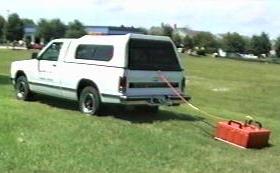
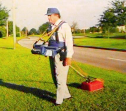
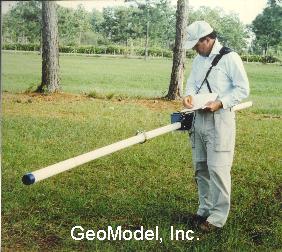
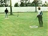
Vehicle-towed GPR survey and Hand-towed GPR survey
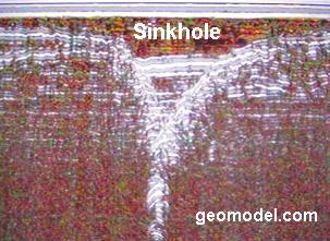
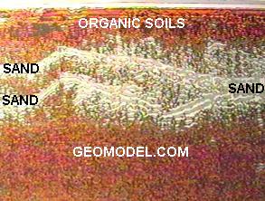
The following are examples of GPR images of geologic features:
Electromagnetic Conductivity (EM)
Electromagnetic conductivity measures the conductivity of the subsurface. This measurement includes the conductivity of soil, groundwater, and rock. GeoModel, Inc. has conducted numerous electromagnetic conductivity (EM) surveys worldwide.
Electromagnetic conductivity surveys are rapid and very accurate. The EM instruments are easily carried and can easily determine variations in ground conductivity that can indicate changes from materials of low conductivity (sand or granite for example) and materials of high conductivity (clay or shale deposits).
GeoModel, Inc.'s geophysicists can perform an EM survey anywhere in the world and with short notice. Survey costs are reasonable.
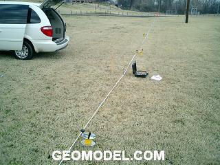
 Geophysicist with EM meter
The EM conductivity meter can investigate the subsurface to a depth of about 20 feet.
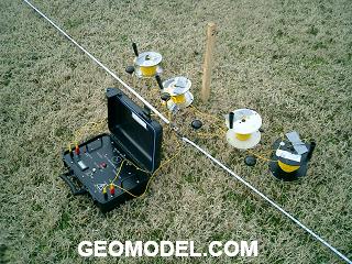
 Deep EM meter in operation
The deeper EM can measure the terrain conductivity of the soil, rock, and ground water from the surface to about 100 feet deep.
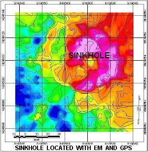 EM survey results
The conductivity contour map of the sinkhole above shows readings that range from low (blue color, outside the sinkhole area) to high (red and pink color, inside the sinkhole area).
Surface Resistivity
Surface resistivity is another method used for investigating the geology of the area. The electrical resistivity of the subsurface materials, which include soil and groundwater characteristics, is measured from survey stations at the ground surface.
Surface resistivity can be used to study lateral and vertical changes in the natural hydrogeologic setting. Surface resistivity can also be used to study contamination of soil and groundwater and to locate buried objects.
The apparent resistivity of the subsurface materials can be calculated by knowing the electrode spacing, geometry of the electrode positions, applied current, and measured voltage. The apparent resistivity values are entered into a computer program that calculates the geoelectric sections or columns for each sounding location, as shown in the images below. Surface resistivity measurements are reported in units of ohm-meters or ohm-feet.
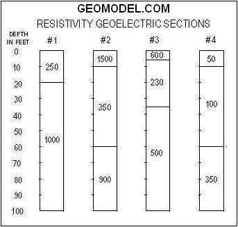
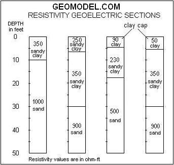
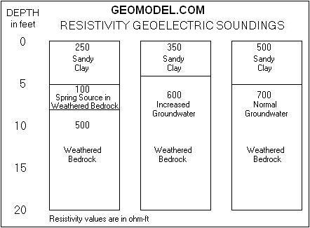
The depth of the resistivity measurement is related to the spacings of the electrodes and may vary depending on the subsurface conditions. The surface resistivity unit has a self-contained transmitter, capable of obtaining data to about 50 to 100 meters (160 to 300 feet), using self-contained, rechargeable batteries.
For a ground penetrating radar survey, click on your state below:
e-mail: ![]() geomodel@geomodel.com
geomodel@geomodel.com
 [Back to Top of page][Back to GPR Applications Page]