
Locating Graves
Contact us: e-mail geomodel@geomodel.com / 703-777-9788
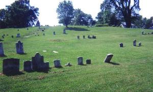
Cemetery Surveys Conducted Nationwide
All surveys are conducted or supervised by Certified Professional Geologists (PG)
GeoModel, Inc. is registered with the FCC and uses only FCC-approved GPR equipment
GeoModel, Inc. uses ground penetrating radar (GPR) for locating marked (known) graves and unmarked, lost, or missing graves quickly and efficiently. A GeoModel, Inc. survey crew can cover large areas in a day depending on the terrain and vegetation cover.
Locating Graves - Introduction
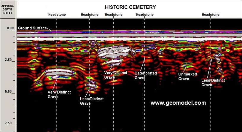
Ground penetrating radar (GPR) surveys are useful for locating graves by detecting the buried casket or vault. Ground penetrating radar is operated above the ground surface, and produces a cross-sectional image of the ground, as shown below. Recent internments (1 to 50 years old) produce very distinct grave anomalies in the GPR profile and are most easily detected. Older graves (50 to 100 years old or more) produce less distinct or minimal anomalies and are more difficult to detect.
Remains of burials are easier to locate in sandy soils that do not contain tree roots or stones. In cases where a vault or casket does not exist, or where the casket has completely deteriorated, GeoModel, Inc. can examine the GPR data for disturbed soil, grave trenches, or other indications of the burial.
GeoModel, Inc. conducts GPR surveys for locating unmarked, lost, or missing graves using a GPR digital control unit and an antenna with a frequency of 400-megaHertz (MHz). A 400-MHz antenna can examine the subsurface to depths of up to 8 feet in sandy soils, but less deep in clayey soils as shown in the profile above.
GPR Surveys for Locating Lost or Missing Graves
GPR surveys for locating unmarked, lost, or missing graves are efficiently conducted. Ground penetrating radar surveys for locating graves can be conducted by one person, hand-towing the antenna. The pictures below show some of the equipment used in a survey and the results that can be obtained.
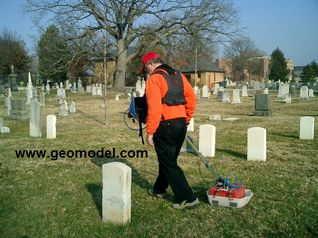
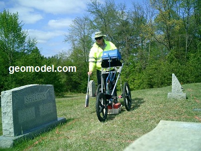
GeoModel, Inc. operator pulling a 400-MHz antenna in a cemetery (above left) and using the GPR survey cart (above right).
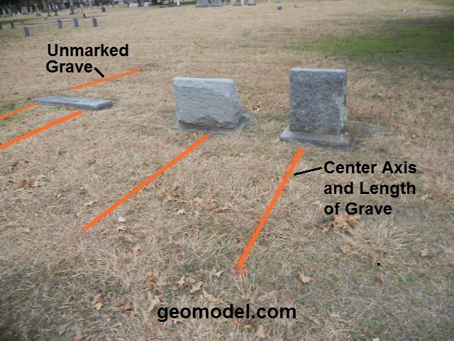
GeoModel, Inc. confirmed gravesites marked with headstones and footstones, and also located unmarked gravesites with minimal or no headstones. Locations of both marked and unmarked graves, the center axis and length, were marked on the ground with orange paint by GeoModel, Inc.
Cemetery and Gravesite Surveys
GeoModel, Inc. conducts ground penetrating radar surveys for locating unmarked, lost or missing gravesites and confirming marked gravesites at cemeteries.
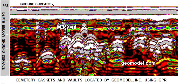
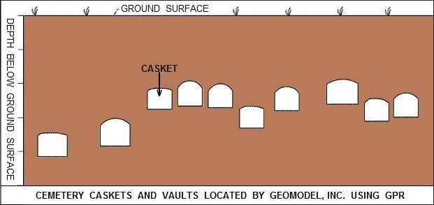
GPR profile and cross-sectional diagram (above) showing several gravesites (caskets) detected using ground penetrating radar (GPR). The soils at this site were very sandy and the caskets produced distinct anomalies. The GPR image shows the condition of the graves, from distinct (more recent internments) to collasped or deteriorated graves (older internments).
GeoModel, Inc. in The News
GeoModel, Inc. has been in the news in Florida for our grave location surveys.
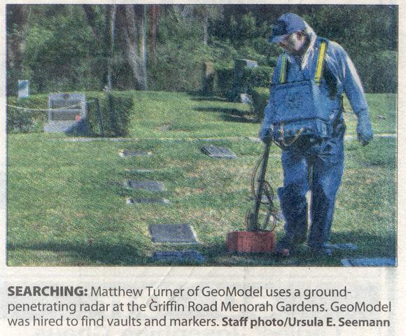
GeoModel, Inc. conducted a ground penetrating radar survey, at a cemetery in south Florida, to locate grave sites.
A local reporter took this photo as GeoModel, Inc. was conducting its survey. The story was covered in the local Sun Sentinel, Florida, newspaper.
Company Background
GeoModel, Inc. was founded in 1991 as a geophysical services and environmental consulting firm. The professionals at GeoModel, Inc. have used ground penetrating radar (GPR) to locate graves for over 20 years. The company principals have over 50 years of combined experience and have conducted numerous ground penetrating radar cemetery and grave location projects worldwide. All projects are conducted or supervised by registered professional geologists.
For a GPR survey to locate graves, click on your state below:
e-mail: ![]() geomodel@geomodel.com
geomodel@geomodel.com
 [Back to Top of Page][Back to GPR Applications]